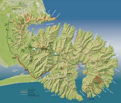


Little River Rail Trail Christchurch to Little River.
The Little River Rail Trail New Zealand starts it's journey in Christchurch Hornby and passes the shores of Lake Ellesmere and Lake Forsyth to end in the small township of Little River.
An enjoyable changing landscape from the farmlands to the wetlands running for around 50km trail comprising of both on and off road cycling.
The Christchurch to Little River Rail Trail Trust was formed to transform the former railway route into a trail catering for walkers and cyclists, wishing to view the region at close quarters. While avoiding the traffic on the busy road between Little River and Christchurch.
Time: Comprising of six sections see each section for completion times. 50 km altogether
Important information: The track is made up of six sections:
Section One: Christchurch (Hornby) to Prebbleton. 3.5km This section starts about 400 m south of the Shands Rd-Halswell Junction Rd intersection on Shands Rd where a small car park is available. The section is sealed and follows Shands Rd to the intersection with Marshs Rd, crosses the road and follows the south side of Marshs Rd to the old railway corridor which takes users through to the village of Prebbleton in the Selwyn District. To connect to the next section of the Railtrail that goes to Lincoln, use the cycle lanes along Springs Rd through Prebbleton, turn left into Birches Rd and pick up the off-road trail just after the Trices Rd intersection.
Section Two: Prebbleton to Lincoln. 7km
This section starts at the Birchs Rd-Trices Rd intersection and is an off-road ashphalt pathway alongside Birchs Rd, and then James St, to the township of Lincoln. It runs alongside the original railway line through pleasant rural surroundings and is wide enough to enable cycling in both directions.
Section Three: Lincoln to Ahuriri Reserve. 10km
From Lincoln township, the Railtrail goes alongside Edward Street. There will be an offroad Railtrail connection built through to Moirs Lan. In the meantime, continue along Edward Street and turn right into Ellesmere Road. After 1.1km on the left there is an offroad Railtrail link that goes through to Collins East Road and River Road. Go right into River Road, which follows alongside the Halswell River, a very attractive spring-fed river that feeds into Lake Ellesmere (Te Waihora).
Section Four: Ahuriri Reserve to Motukarara. 6km
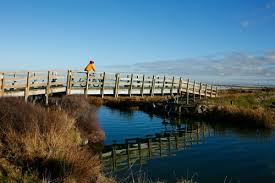
This section is off-road and the surface is hardpacked gravel. The route is adjacent to the Halswell Canal but deviates away onto farmland for a approximately 1.7 km to reduce the impact of disturbance on the visiting bird life. The bird life will be a key attraction of this unique wetland area. The Waihora Ellesmere Trust (WET), Rail Trail Trust and ECan are working together to enhance the wetland for wildlife, and provide interpretation signage to promote the importance of this wetland ecosystem and inform Railtrail users of its sensitivity and value to the environment.
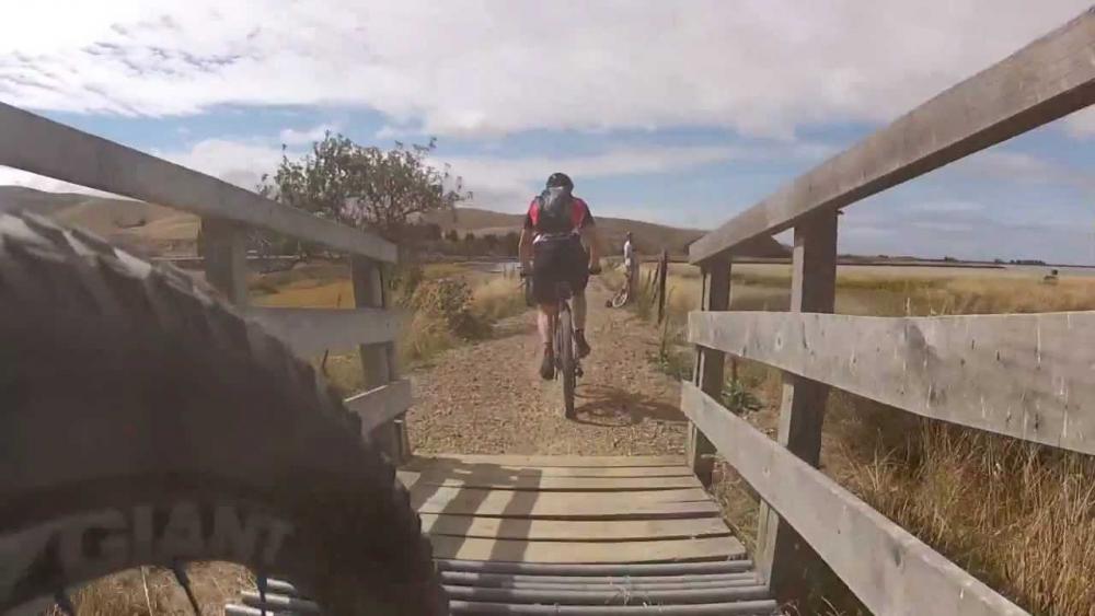
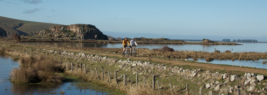
Section Five: Motukarara to Birdlings Flat. 13km
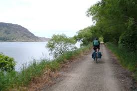
Most of this section of the Railtrail runs alongside Te Waihora (Lake Ellesmere), where the railway embankment is raised above the lake and adjoining wetlands, affording magnificent views of the surroundings and the prolific birdlife.
Section Six: Birdlings Flat to Little River. 9km
Most of this section traverses along the old railway embankment beside Te Roto o Waiewa (Lake Forsyth). The Railtrail currently ends at Kinloch Road, a few hundred metres from the Little River township.