


Mt Thomas 40 minutes drive from Christchurch central is part of the Mt Thomas forest park.
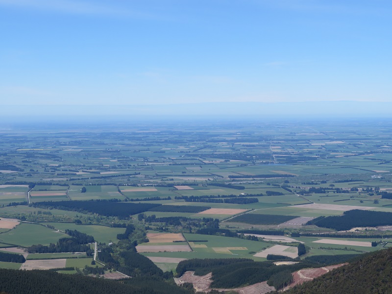
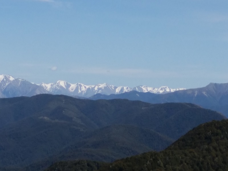
To the top of the summit it is 1023m where you can sit and take in the fantastic views of the Canterbury Plains, Banks Peninsula and the Southern Alps.
You will also see thousands of beach trees as you walk the track coverd in honey dew, great for the honey bees.
And if you want drink form the crystal clear streams and listen to New Zealand native birds singing their song.
5 Hours at a steady walk "there are shorter options if you dont wish to go all the way to the summit"
The summit can be reached from two ways one through the beach forest the other through the pine forest to the right of the carpark and most people do the loop.
Taking the ridge and wooded gully track through the beach forest is worth doing however note it is is steep "undulating" and you need to be able to navigate across small streams and rough terrain if your not used to walking up hill this will be a fairly hard climb.
Taking the pine forest track is just steep all the way no undulating or flat ground relief however the track is easy to walk on note though it is still a good workout.
With both ways go prepared good shoes water and food and take some warm clothes just in case it can get cold up there even in the summer.
Once you have reached the summit the views are worth the climb so give it a go.


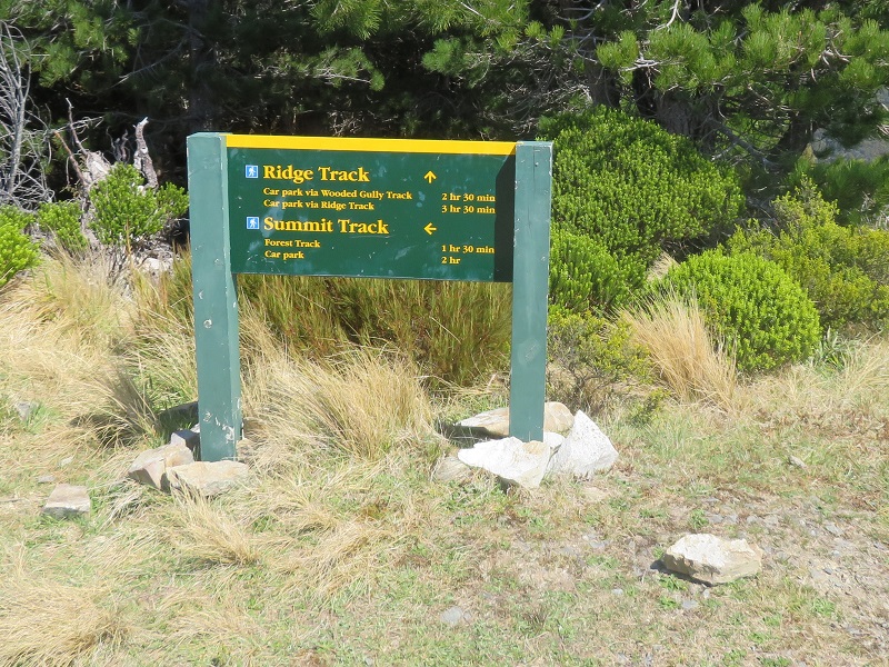
Mt Thomas tracks
Combine these tracks for a circuit over Mt Thomas.
Summit Track
Time: 2 hr to the summit
From the picnic area follow Summit Track up a steep ridge to the summit of Mt Thomas. Come back the same way or return to the car park via either Wooded Gully or Ridge Tracks.
Ridge Track
Time: 3 hr 30 min to the summit
Ridge Track starts at the campground end of Wooded Gully picnic area. Follow the forestry road uphill for about 800 m to where the turn-off to the track is signposted. Follow the ridge up to the junction with Bob's Camp Biv Route (2 hr 30 min). This is the highest point of the ridge before it heads in an easterly direction to Mt Thomas summit (1 hr). Wooded Gully and Summit Tracks branch off this track and you can take either back to the picnic area.
Wooded Gully Track
Time: 2 hr 30 min to the summit
From Wooded Gully picnic area walk up Wooded Gully Track through beech forest to the junction with the Ridge Track (2 hr). This is a popular walk with the whole track passing through native forest to the saddle and crossing the steam twice. From the junction you can return the same way, climb to the summit of Mt Thomas (30 min) and return via Summit Track, or follow Ridge Track back to Wooded Gully picnic area past the Bobs Camp Biv turn-off.
Getting there
These tracks start from the Wooded Gully camping and picnic area.
From Oxford, follow Ashley Gorge Road for 13 km to Glentui. Continue on Birch Hill Road for 6 km then turn into Hayland Road and follow this for 4 km to the end.
Heads Up
Wasp populations reach high numbers from January to March – wear light-coloured clothing and carry antihistamine cream/tablets as a precaution.